top of page
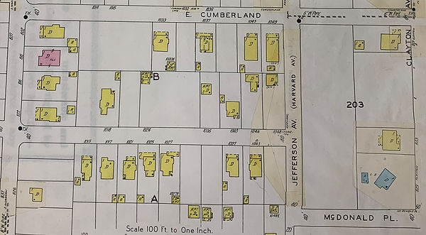
The Sanborn Fire Insurance Company released maps periodically describing the shape and building components (like wood frame versus masonry). The following map images are from their January 1929 publication. Areas that appear to have been pasted-in were from subsequent publications that the Lakeland Library used to later supplement the 1929 publication. The 1929 map did not detail the east side of Clayton Ave or Hollingsworth Road, from McDonald north, so we have to use other sources for those homes. Similarly, almost all north Biltmore is omitted (Wilson, Francis, Bartow, Lime and Walnut) except for the SE lots between Ingraham and Biltmore Drive (sic, noted as Baltimore).


bottom of page